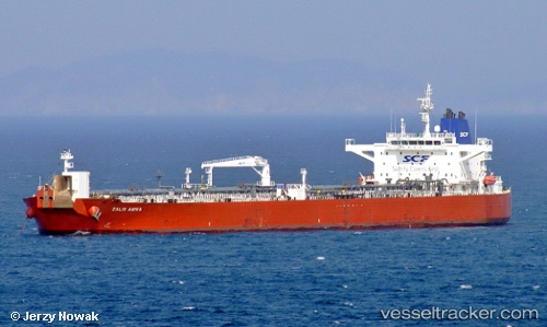
 ZALIV ANIVA
Current Status
Where is the vessel?
ZALIV ANIVA is currently in 94 nm NW of OKUSHIRI, based on AIS data received about 14h ago.
Latest AIS update:
Current position: 43.52470° N, 138.42593° E (94 nm NW of OKUSHIRI)
Average speed (last 7 days): Loading…
Average speed (last 30 days): Loading…
Vessel profile: ZALIV ANIVA is a Crude Oil Tanker with dimensions m x m.
This page combines live AIS, route history, probable destination signals, nearby traffic, and port activity for practical vessel monitoring.
The current position of vessel ZALIV ANIVA is 43.52470 lat / 138.42593 lng. Updated: 2026-06-22 14:03:35 UTCNearest reference points:
- 90 nm NW of OKUSHIRI
- 37 nm SW of PLASTUN
- Near Muroran
Currently sailing under the flag of Oman ![]()
Details:
Live Vessel ZALIV ANIVA Analytics (details, animations, etc.)
Recent AIS points (UTC):
2026-06-22 08:38:24 UTC · 42.90281, 137.80409 · SOG 8.6 kn · COG -1°2026-06-22 11:16:48 UTC · 43.20695, 138.11151 · SOG 8.7 kn · COG -1°
2026-06-22 11:16:48 UTC · 43.20695, 138.11151 · SOG 8.7 kn · COG -1°
2026-06-22 14:03:35 UTC · 43.52470, 138.42593 · SOG 8.4 kn · COG -1°