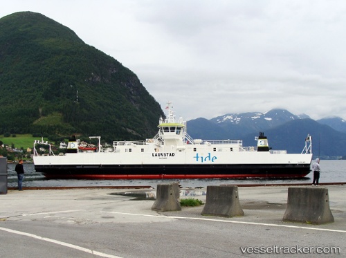
 Lauvstad
Current Status
Where is the vessel?
Lauvstad is currently in Near Lyngseidet, based on AIS data received about 14h ago.
Latest AIS update:
Current position: 69.57844° N, 20.30758° E (Near Lyngseidet)
Average speed (last 7 days): Loading…
Average speed (last 30 days): Loading…
Vessel profile: Lauvstad is a Passenger Ro Ro Cargo Ship with dimensions 64m x 14m.
This page combines live AIS, route history, probable destination signals, nearby traffic, and port activity for practical vessel monitoring.
The current position of vessel Lauvstad is 69.57844 lat / 20.30758 lng. Updated: 2026-06-13 11:38:06 UTCNearest reference points:
- Near Sørkjosen
- Near Skjervøy
- Near Tromsø
Currently sailing under the flag of Norway ![]()
Details:
Live Vessel Lauvstad Analytics (details, animations, etc.)
Recent AIS points (UTC):
2026-06-13 07:50:31 UTC · 69.57698, 20.22468 · SOG 0 kn · COG 123°2026-06-13 10:04:42 UTC · 69.58223, 20.33417 · SOG 10.4 kn · COG 71°
2026-06-13 10:27:02 UTC · 69.60241, 20.51500 · SOG 11.2 kn · COG 90°
2026-06-13 11:38:06 UTC · 69.57844, 20.30758 · SOG 11.2 kn · COG 72°