 Nord Stingray
Current Status
Where is the vessel?
Nord Stingray is currently in 11 nm E of Benito Juarez, based on AIS data received about 16h ago.
Latest AIS update:
Current position: 22.15847° N, 97.65708° W (11 nm E of Benito Juarez)
Average speed (last 7 days): Loading…
Average speed (last 30 days): Loading…
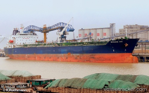
Vessel profile: Nord Stingray is a Chemical Oil Products Tanker with dimensions 183m x 32m.
This page combines live AIS, route history, probable destination signals, nearby traffic, and port activity for practical vessel monitoring.
The current position of vessel Nord Stingray is 22.15847 lat / -97.65708 lng. Updated: 2026-06-17 02:03:51 UTCNearest reference points:
- 25 nm E of Tuxpan
Currently sailing under the flag of Malta ![]()
Nord Stingray built in 2009 year
Deadweight:
51291 tDetails:
Live Vessel Nord Stingray Analytics (details, animations, etc.)
Recent AIS points (UTC):
2026-06-16 22:28:19 UTC · 21.55500, -97.14333 · SOG 13 kn · COG -1°2026-06-16 23:25:42 UTC · 21.72010, -97.28430 · SOG 13.3 kn · COG 324°
2026-06-17 01:55:52 UTC · 22.14874, -97.63653 · SOG 10.6 kn · COG 275°
2026-06-17 02:03:51 UTC · 22.15847, -97.65708 · SOG 9.5 kn · COG 306°