Kacey
Current StatusWhere is the vessel?
Kacey is currently in 28 nm SE of El Alquian, based on AIS data received about 14h ago.
Latest AIS update:
Current position: 36.44409° N, 2.08148° W (28 nm SE of El Alquian)
Average speed (last 7 days): Loading…
Average speed (last 30 days): Loading…
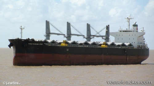
Vessel profile: Kacey is a Bulk Carrier with dimensions 32m x 190m.
This page combines live AIS, route history, probable destination signals, nearby traffic, and port activity for practical vessel monitoring.
The current position of vessel Kacey is 36.44409 lat / -2.08148 lng. Updated: 2026-05-20 22:12:18 UTCNearest reference points:
- 27 nm SE of El Alquian
- 26 nm S of El Alquian
- 20 nm SE of CARBONERAS
Details:
Live Vessel Kacey Analytics (details, animations, etc.)
Recent AIS points (UTC):
2026-05-20 16:51:48 UTC · 36.68929, -0.66196 · SOG 13.2 kn · COG 257°2026-05-20 17:32:58 UTC · 36.66160, -0.84581 · SOG 13 kn · COG 260°
2026-05-20 22:05:28 UTC · 36.44949, -2.05152 · SOG 13 kn · COG 258°
2026-05-20 22:12:18 UTC · 36.44409, -2.08148 · SOG 13 kn · COG 257°