 KINGSTON
Current Status
Where is the vessel?
KINGSTON is currently in 22 nm N of Port Said, based on AIS data received about 15h ago.
Latest AIS update:
Current position: 31.63636° N, 32.36894° E (22 nm N of Port Said)
Average speed (last 7 days): Loading…
Average speed (last 30 days): Loading…
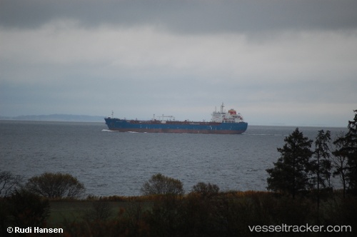
Vessel profile: KINGSTON is a Chemical Oil Products Tanker with dimensions 183m x 27m.
This page combines live AIS, route history, probable destination signals, nearby traffic, and port activity for practical vessel monitoring.
The current position of vessel KINGSTON is 31.63636 lat / 32.36894 lng. Updated: 2026-05-20 19:29:07 UTCNearest reference points:
- 16 nm N of Port Said
- 14 nm N of Port Said
- 15 nm N of Port Said
Currently sailing under the flag of Liberia ![]()
KINGSTON built in 2009 year
Deadweight:
38349 tDetails:
Live Vessel KINGSTON Analytics (details, animations, etc.)
Recent AIS points (UTC):
2026-05-20 15:53:07 UTC · 31.63635, 32.36897 · SOG 0.1 kn · COG 298°2026-05-20 16:08:06 UTC · 31.63643, 32.36894 · SOG 0.1 kn · COG 297°
2026-05-20 17:59:07 UTC · 31.63630, 32.36894 · SOG 0.2 kn · COG 299°
2026-05-20 19:29:07 UTC · 31.63636, 32.36894 · SOG 0.1 kn · COG 298°