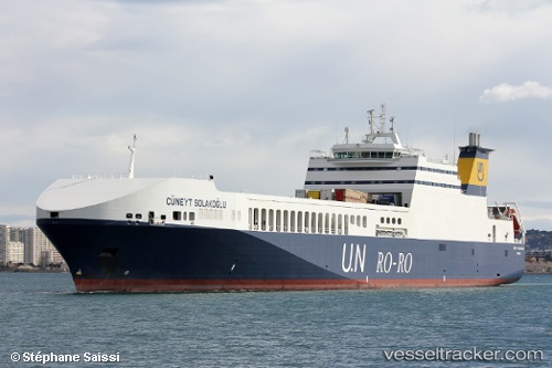
 Cuneyt Solakoglu
Current Status
Where is the vessel?
Cuneyt Solakoglu is currently in 12 nm SW of ZAKYNTHOS, based on AIS data received about 14h ago.
Latest AIS update:
Current position: 37.63202° N, 20.74150° E (12 nm SW of ZAKYNTHOS)
Average speed (last 7 days): Loading…
Average speed (last 30 days): Loading…
Vessel profile: Cuneyt Solakoglu is a Ro Ro Cargo Ship with dimensions 223m x 26m.
This page combines live AIS, route history, probable destination signals, nearby traffic, and port activity for practical vessel monitoring.
The current position of vessel Cuneyt Solakoglu is 37.63202 lat / 20.74150 lng. Updated: 2026-06-22 17:28:29 UTCNearest reference points:
- Near MESSOLOGGI
- Near Káto Achaïa
- Near Meganísi
Currently sailing under the flag of Turkey ![]()
Cuneyt Solakoglu built in 2009 year
Deadweight:
11478 tDetails:
Live Vessel Cuneyt Solakoglu Analytics (details, animations, etc.)
Recent AIS points (UTC):
2026-06-22 14:07:51 UTC · 37.13377, 21.23935 · SOG 11 kn · COG 322°2026-06-22 15:39:20 UTC · 37.35803, 21.02283 · SOG 11.5 kn · COG 323°
2026-06-22 16:26:59 UTC · 37.47809, 20.89958 · SOG 11.8 kn · COG 323°
2026-06-22 17:28:29 UTC · 37.63202, 20.74150 · SOG 11.5 kn · COG 320°