 MARI GALAXY
Current Status
Where is the vessel?
MARI GALAXY is currently in Near Miramar, based on AIS data received about 14h ago.
Latest AIS update:
Current position: 22.47695° N, 97.88746° W (Near Miramar)
Average speed (last 7 days): Loading…
Average speed (last 30 days): Loading…
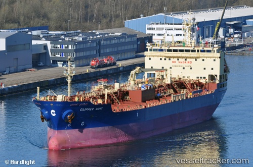
Vessel profile: MARI GALAXY is a Oil/Chemical Tanker with dimensions m x m.
This page combines live AIS, route history, probable destination signals, nearby traffic, and port activity for practical vessel monitoring.
The current position of vessel MARI GALAXY is 22.47695 lat / -97.88746 lng. Updated: 2026-05-21 04:49:07 UTCNearest reference points:
- 25 nm E of Tuxpan
Currently sailing under the flag of Singapore ![]()
Details:
Live Vessel MARI GALAXY Analytics (details, animations, etc.)
Recent AIS points (UTC):
2026-05-21 02:16:06 UTC · 22.47696, -97.88749 · SOG 0 kn · COG 348°2026-05-21 02:19:06 UTC · 22.47694, -97.88746 · SOG 0 kn · COG 348°
2026-05-21 04:13:06 UTC · 22.47695, -97.88749 · SOG 0 kn · COG 348°
2026-05-21 04:49:07 UTC · 22.47695, -97.88746 · SOG 0 kn · COG 348°