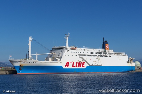
Ferry Akebono
Current StatusWhere is the vessel?
Ferry Akebono is currently in Near Kagoshima, based on AIS data received about 15h ago.
Latest AIS update:
Current position: 31.58043° N, 130.56783° E (Near Kagoshima)
Average speed (last 7 days): Loading…
Average speed (last 30 days): Loading…
Vessel profile: Ferry Akebono is a Passenger Ro Ro Cargo Ship with dimensions 24m x 145m.
This page combines live AIS, route history, probable destination signals, nearby traffic, and port activity for practical vessel monitoring.
The current position of vessel Ferry Akebono is 31.58043 lat / 130.56783 lng. Updated: 2026-05-21 01:37:37 UTCNearest reference points:
- Near Kagoshima
- Near Kiire
- Near YAMAGAWA
Details:
Live Vessel Ferry Akebono Analytics (details, animations, etc.)
Recent AIS points (UTC):
2026-05-20 22:54:06 UTC · 31.58045, 130.56783 · SOG 0 kn · COG 54°2026-05-21 00:22:56 UTC · 31.58040, 130.56778 · SOG 0 kn · COG 54°
2026-05-21 01:21:56 UTC · 31.58045, 130.56787 · SOG 0 kn · COG 54°
2026-05-21 01:37:37 UTC · 31.58043, 130.56783 · SOG 0 kn · COG 54°