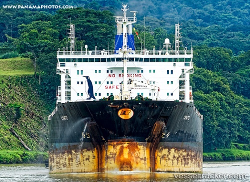
 FIDAN
FIDAN
Current Status
Where is the vessel?
FIDAN is currently in Near Paranagua, based on AIS data received about 15h ago.
Latest AIS update:
Current position: 25.50125° S, 48.53330° W (Near Paranagua)
Average speed (last 7 days): Loading…
Average speed (last 30 days): Loading…
Vessel profile: FIDAN is a Chemical/Oil Products Tanker with dimensions 183m x 32m.
This page combines live AIS, route history, probable destination signals, nearby traffic, and port activity for practical vessel monitoring.
The current position of vessel FIDAN is -25.50125 lat / -48.53330 lng. Updated: 2026-05-20 13:51:14 UTCNearest reference points:
- 24 nm E of Caioba
- 32 nm E of Caioba
- Near Itajai
Currently sailing under the flag of Marshall Islands ![]()
FIDAN built in 2009 year
Deadweight:
49999 tDetails:
Live Vessel FIDAN Analytics (details, animations, etc.)
Recent AIS points (UTC):
2026-05-20 11:05:49 UTC · -25.49425, -48.45454 · SOG 10.3 kn · COG 270°2026-05-20 12:00:08 UTC · -25.50107, -48.53214 · SOG 0.8 kn · COG 258°
2026-05-20 13:42:14 UTC · -25.50126, -48.53333 · SOG 0 kn · COG 257°
2026-05-20 13:51:14 UTC · -25.50125, -48.53330 · SOG 0 kn · COG 257°