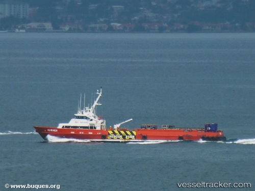
Mariner
Current StatusWhere is the vessel?
Mariner is currently in 25 nm N of Diego Martin, based on AIS data received about 14h ago.
Latest AIS update:
Current position: 11.13288° N, 61.59873° W (25 nm N of Diego Martin)
Average speed (last 7 days): Loading…
Average speed (last 30 days): Loading…
Vessel profile: Mariner is a Offshore Tug Supply Ship with dimensions 10m x 44m.
This page combines live AIS, route history, probable destination signals, nearby traffic, and port activity for practical vessel monitoring.
The current position of vessel Mariner is 11.13288 lat / -61.59873 lng. Updated: 2026-07-25 11:39:11 UTCNearest reference points:
- Near CARENAGE
- Near Caroni
- Near Carenage
Details:
Live Vessel Mariner Analytics (details, animations, etc.)
Recent AIS points (UTC):
2026-07-25 08:25:32 UTC · 10.68022, -61.63927 · SOG 0.1 kn · COG 182°2026-07-25 09:56:00 UTC · 10.76666, -61.67175 · SOG 14.7 kn · COG 0°
2026-07-25 10:33:52 UTC · 10.91272, -61.65192 · SOG 13.7 kn · COG 10°
2026-07-25 11:39:11 UTC · 11.13288, -61.59873 · SOG 12.3 kn · COG 29°