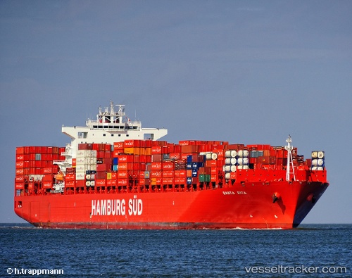
 Santa Rita
Current Status
Where is the vessel?
Santa Rita is currently in 32 nm SE of ZHOUSHAN, based on AIS data received about 14h ago.
Latest AIS update:
Current position: 29.67484° N, 122.71466° E (32 nm SE of ZHOUSHAN)
Average speed (last 7 days): Loading…
Average speed (last 30 days): Loading…
Vessel profile: Santa Rita is a Container Ship with dimensions 300m x 43m.
This page combines live AIS, route history, probable destination signals, nearby traffic, and port activity for practical vessel monitoring.
The current position of vessel Santa Rita is 29.67484 lat / 122.71466 lng. Updated: 2026-05-19 21:24:05 UTCNearest reference points:
- 30 nm SE of ZHOUSHAN
- 31 nm SE of ZHOUSHAN
- 36 nm SE of ZHOUSHAN
Currently sailing under the flag of Denmark ![]()
Santa Rita built in 2011 year
Deadweight:
93404 tDetails:
Live Vessel Santa Rita Analytics (details, animations, etc.)
Recent AIS points (UTC):
2026-05-19 17:35:25 UTC · 29.73072, 123.38375 · SOG 9 kn · COG 230°2026-05-19 19:36:03 UTC · 29.64500, 123.04333 · SOG 9 kn · COG -1°
2026-05-19 20:02:54 UTC · 29.65064, 122.96254 · SOG 9.5 kn · COG 272°
2026-05-19 21:24:05 UTC · 29.67484, 122.71466 · SOG 9.4 kn · COG 278°