 Kanala
Current Status
Where is the vessel?
Kanala is currently in 22 nm S of Yucatan Channel, based on AIS data received about 14h ago.
Latest AIS update:
Current position: 21.47667° N, 85.14333° W (22 nm S of Yucatan Channel)
Average speed (last 7 days): Loading…
Average speed (last 30 days): Loading…
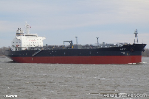
Vessel profile: Kanala is a Oil Products Tanker with dimensions 183m x 32m.
This page combines live AIS, route history, probable destination signals, nearby traffic, and port activity for practical vessel monitoring.
The current position of vessel Kanala is 21.47667 lat / -85.14333 lng. Updated: 2026-07-02 23:23:49 UTCNearest reference points:
- 58 nm S of San Julian
- Near Puerto Juárez
- Near Mariel
Currently sailing under the flag of Malta ![]()
Kanala built in 2010 year
Deadweight:
50090 tDetails:
Live Vessel Kanala Analytics (details, animations, etc.)
Recent AIS points (UTC):
2026-07-02 19:31:25 UTC · 22.30616, -85.23563 · SOG 13 kn · COG -1°2026-07-02 21:38:43 UTC · 21.82833, -85.22333 · SOG 13 kn · COG -1°
2026-07-02 21:53:44 UTC · 21.77333, -85.22167 · SOG 13 kn · COG -1°
2026-07-02 23:23:49 UTC · 21.47667, -85.14333 · SOG 12 kn · COG -1°