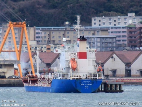
 New Harmony
Current Status
Where is the vessel?
New Harmony is currently in Near Incheon, based on AIS data received about 14h ago.
Latest AIS update:
Current position: 37.45563° N, 126.57643° E (Near Incheon)
Average speed (last 7 days): Loading…
Average speed (last 30 days): Loading…
Vessel profile: New Harmony is a Chemical Oil Products Tanker with dimensions 105m x 16m.
This page combines live AIS, route history, probable destination signals, nearby traffic, and port activity for practical vessel monitoring.
The current position of vessel New Harmony is 37.45563 lat / 126.57643 lng. Updated: 2026-07-15 04:05:32 UTCNearest reference points:
- Near Incheon
- Near Gyeongin
- 14 nm SW of Incheon
Currently sailing under the flag of Korea ![]()
Details:
Live Vessel New Harmony Analytics (details, animations, etc.)
Recent AIS points (UTC):
2026-07-15 00:38:32 UTC · 37.45378, 126.57480 · SOG 0.1 kn · COG 354°2026-07-15 01:29:32 UTC · 37.45376, 126.57477 · SOG 0 kn · COG 0°
2026-07-15 02:17:32 UTC · 37.45394, 126.57477 · SOG 0.1 kn · COG 347°
2026-07-15 04:05:32 UTC · 37.45563, 126.57643 · SOG 0 kn · COG 235°