 CURACAO
Current Status
Where is the vessel?
CURACAO is currently in 11 nm S of Mount Pleasant, based on AIS data received about 14h ago.
Latest AIS update:
Current position: 34.18688° S, 25.52095° E (11 nm S of Mount Pleasant)
Average speed (last 7 days): Loading…
Average speed (last 30 days): Loading…
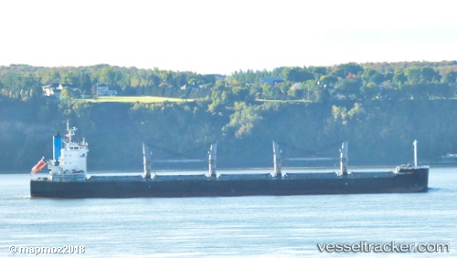
Vessel profile: CURACAO is a Bulk Carrier with dimensions 190m x 32m.
This page combines live AIS, route history, probable destination signals, nearby traffic, and port activity for practical vessel monitoring.
The current position of vessel CURACAO is -34.18688 lat / 25.52095 lng. Updated: 2026-05-19 17:28:06 UTCNearest reference points:
- 21 nm S of Mount Pleasant
- Near Deal Party
Currently sailing under the flag of Liberia ![]()
CURACAO built in 2011 year
Deadweight:
57937 tDetails:
Live Vessel CURACAO Analytics (details, animations, etc.)
Recent AIS points (UTC):
2026-05-19 14:22:26 UTC · -34.29677, 24.98834 · SOG 8.8 kn · COG 85°2026-05-19 15:59:36 UTC · -34.25586, 25.27105 · SOG 8.9 kn · COG 73°
2026-05-19 16:46:55 UTC · -34.21921, 25.40369 · SOG 8.7 kn · COG 73°
2026-05-19 17:28:06 UTC · -34.18688, 25.52095 · SOG 8.9 kn · COG 73°