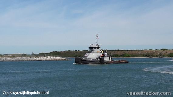
Duty
Current StatusWhere is the vessel?
Duty is currently in Near GUAYANILLA, based on AIS data received about 14h ago.
Latest AIS update:
Current position: 18.00601° N, 66.76496° W (Near GUAYANILLA)
Average speed (last 7 days): Loading…
Average speed (last 30 days): Loading…
Vessel profile: Duty is a Tug with dimensions 10m x 33m.
This page combines live AIS, route history, probable destination signals, nearby traffic, and port activity for practical vessel monitoring.
The current position of vessel Duty is 18.00601 lat / -66.76496 lng. Updated: 2026-05-20 21:51:35 UTCNearest reference points:
- Near Guanica
- Near San Juan
- Near Roosevelt Roads
Details:
Live Vessel Duty Analytics (details, animations, etc.)
Recent AIS points (UTC):
2026-05-20 16:25:01 UTC · 18.00604, -66.76497 · SOG 0 kn · COG 68°2026-05-20 17:25:42 UTC · 18.00606, -66.76498 · SOG 0 kn · COG 66°
2026-05-20 19:29:52 UTC · 18.00604, -66.76494 · SOG 0 kn · COG 67°
2026-05-20 21:51:35 UTC · 18.00601, -66.76496 · SOG 0 kn · COG 64°