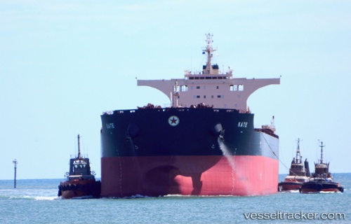
 Kate
Kate
Current Status
Where is the vessel?
Kate is currently in 309 nm N of Mutineer, based on AIS data received about 14h ago.
Latest AIS update:
Current position: 14.11500° S, 116.68500° E (309 nm N of Mutineer)
Average speed (last 7 days): Loading…
Average speed (last 30 days): Loading…
Vessel profile: Kate is a Bulk Carrier with dimensions 292m x 292m.
This page combines live AIS, route history, probable destination signals, nearby traffic, and port activity for practical vessel monitoring.
The current position of vessel Kate is -14.11500 lat / 116.68500 lng. Updated: 2026-05-25 04:27:10 UTCNearest reference points:
- 244 nm N of Mutineer
Currently sailing under the flag of Marshall Is ![]()
Kate built in 2011 year
Deadweight:
176405 tDetails:
Live Vessel Kate Analytics (details, animations, etc.)
Recent AIS points (UTC):
2026-05-24 23:47:43 UTC · -13.33892, 116.44339 · SOG 10.5 kn · COG 162°2026-05-25 01:24:03 UTC · -13.60667, 116.52667 · SOG 10 kn · COG -1°
2026-05-25 04:11:53 UTC · -14.07345, 116.67104 · SOG 10.4 kn · COG 164°
2026-05-25 04:27:10 UTC · -14.11500, 116.68500 · SOG 10 kn · COG -1°