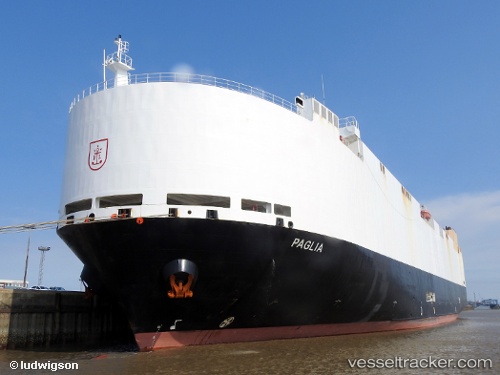
 VIKING PAGLIA
Current Status
Where is the vessel?
VIKING PAGLIA is currently in Near Chermside, based on AIS data received about 16h ago.
Latest AIS update:
Current position: 27.37609° S, 153.16588° E (Near Chermside)
Average speed (last 7 days): Loading…
Average speed (last 30 days): Loading…
Vessel profile: VIKING PAGLIA is a Vehicles Carrier with dimensions m x m.
This page combines live AIS, route history, probable destination signals, nearby traffic, and port activity for practical vessel monitoring.
The current position of vessel VIKING PAGLIA is -27.37609 lat / 153.16588 lng. Updated: 2026-05-19 19:44:40 UTCNearest reference points:
- Near Wynnum West
- Near Hemmant
- Near Eagle Farm
Currently sailing under the flag of Marshall Islands ![]()
Details:
Live Vessel VIKING PAGLIA Analytics (details, animations, etc.)
Recent AIS points (UTC):
2026-05-19 16:26:54 UTC · -26.82280, 153.15303 · SOG 14.9 kn · COG 235°2026-05-19 18:27:59 UTC · -27.24555, 153.31824 · SOG 15.5 kn · COG 239°
2026-05-19 19:17:59 UTC · -27.35703, 153.17648 · SOG 7.1 kn · COG 210°
2026-05-19 19:44:40 UTC · -27.37609, 153.16588 · SOG 1 kn · COG 2°