 vesseltracker.com
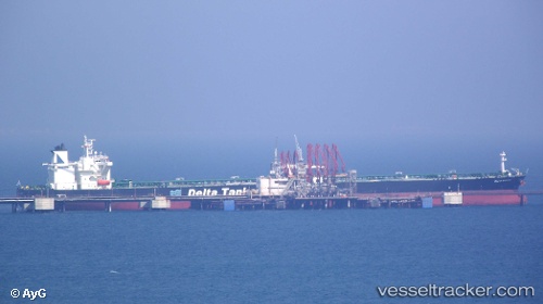
 DELTA KANARIS
Current Status
Where is the vessel?
DELTA KANARIS is currently in 25 nm SE of Skíros, based on AIS data received about 14h ago.
Latest AIS update:
Current position: 38.71553° N, 25.04070° E (25 nm SE of Skíros)
Average speed (last 7 days): Loading…
Average speed (last 30 days): Loading…
Vessel profile: DELTA KANARIS is a Crude Oil Tanker with dimensions 274m x 274m.
This page combines live AIS, route history, probable destination signals, nearby traffic, and port activity for practical vessel monitoring.
The current position of vessel DELTA KANARIS is 38.71553 lat / 25.04070 lng. Updated: 2026-05-17 23:40:42 UTCNearest reference points:
- 16 nm E of Skíros
- 28 nm NW of Psará
- 29 nm SW of Sigri Lesvou
Currently sailing under the flag of Liberia ![]()
DELTA KANARIS built in 2010 year
Deadweight:
157563 tDetails:
Live Vessel DELTA KANARIS Analytics (details, animations, etc.)
Recent AIS points (UTC):
2026-05-17 19:33:43 UTC · 38.03467, 24.69627 · SOG 10.8 kn · COG 32°2026-05-17 21:55:54 UTC · 38.42613, 24.89032 · SOG 10.4 kn · COG 20°
2026-05-17 23:06:13 UTC · 38.62102, 24.98843 · SOG 10.8 kn · COG 23°
2026-05-17 23:40:42 UTC · 38.71553, 25.04070 · SOG 10.8 kn · COG 18°