Sc Emerald
Current StatusWhere is the vessel?
Sc Emerald is currently in 39 nm NE of Hat Yai International Apt, based on AIS data received about 16h ago.
Latest AIS update:
Current position: 7.50167° N, 100.71333° E (39 nm NE of Hat Yai International Apt)
Average speed (last 7 days): Loading…
Average speed (last 30 days): Loading…
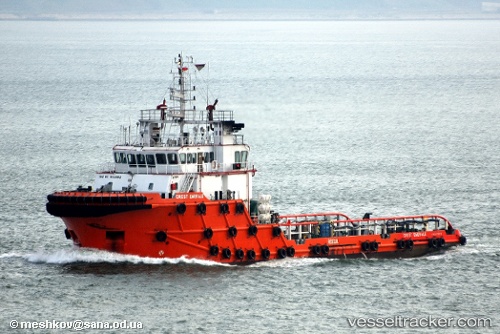
Vessel profile: Sc Emerald is a Offshore Tug Supply Ship with dimensions 14m x 58m.
This page combines live AIS, route history, probable destination signals, nearby traffic, and port activity for practical vessel monitoring.
The current position of vessel Sc Emerald is 7.50167 lat / 100.71333 lng. Updated: 2026-05-21 19:24:44 UTCNearest reference points:
- Near LANGKAWI
- 13 nm SW of Sathun
- Near Tanjung Lembung
Details:
Live Vessel Sc Emerald Analytics (details, animations, etc.)
Recent AIS points (UTC):
2026-05-21 15:54:44 UTC · 7.88500, 100.86666 · SOG 6 kn · COG -1°2026-05-21 17:36:45 UTC · 7.70167, 100.79167 · SOG 7 kn · COG -1°
2026-05-21 19:24:44 UTC · 7.50167, 100.71333 · SOG 7 kn · COG -1°
2026-05-21 19:24:44 UTC · 7.50167, 100.71333 · SOG 7 kn · COG -1°