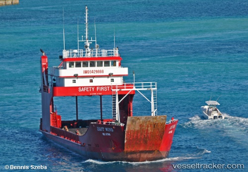
East Wind
Current StatusWhere is the vessel?
East Wind is currently in 12 nm E of Bock Cay, based on AIS data received about 15h ago.
Latest AIS update:
Current position: 23.74600° N, 75.95590° W (12 nm E of Bock Cay)
Average speed (last 7 days): Loading…
Average speed (last 30 days): Loading…
Vessel profile: East Wind is a Ro Ro Cargo Ship with dimensions 11m x 54m.
This page combines live AIS, route history, probable destination signals, nearby traffic, and port activity for practical vessel monitoring.
The current position of vessel East Wind is 23.74600 lat / -75.95590 lng. Updated: 2026-05-22 23:02:52 UTCNearest reference points:
- Near Great Exuma Island
- 30 nm SW of Cape Eleuthera
- 29 nm SW of Cape Eleuthera
Details:
Live Vessel East Wind Analytics (details, animations, etc.)
Recent AIS points (UTC):
2026-05-22 19:35:13 UTC · 23.50758, -75.76726 · SOG 0 kn · COG -1°2026-05-22 20:21:03 UTC · 23.50757, -75.76727 · SOG 0 kn · COG -1°
2026-05-22 21:39:02 UTC · 23.55601, -75.80537 · SOG 8.5 kn · COG -1°
2026-05-22 23:02:52 UTC · 23.74600, -75.95590 · SOG 10.2 kn · COG -1°