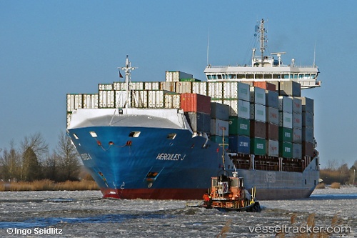
 Hercules J
Current Status
Where is the vessel?
Hercules J is currently in 44 nm W of Jorf Lasfar, based on AIS data received about 15h ago.
Latest AIS update:
Current position: 33.39945° N, 9.42346° W (44 nm W of Jorf Lasfar)
Average speed (last 7 days): Loading…
Average speed (last 30 days): Loading…
Vessel profile: Hercules J is a Container Ship with dimensions 151m x 151m.
This page combines live AIS, route history, probable destination signals, nearby traffic, and port activity for practical vessel monitoring.
The current position of vessel Hercules J is 33.39945 lat / -9.42346 lng. Updated: 2026-05-20 11:39:26 UTCNearest reference points:
- 51 nm NW of Jorf Lasfar
- 52 nm NW of Safi
- 21 nm NW of El Jadida
Currently sailing under the flag of Cyprus ![]()
Hercules J built in 2009 year
Deadweight:
12893 tDetails:
Live Vessel Hercules J Analytics (details, animations, etc.)
Recent AIS points (UTC):
2026-05-20 07:30:04 UTC · 34.22799, -8.49069 · SOG 16.3 kn · COG 228°2026-05-20 09:55:38 UTC · 33.77810, -9.07937 · SOG 16.5 kn · COG 226°
2026-05-20 10:33:32 UTC · 33.64024, -9.20687 · SOG 16.4 kn · COG 217°
2026-05-20 11:39:26 UTC · 33.39945, -9.42346 · SOG 16.4 kn · COG 217°