 Santa Ursula
Current Status
Where is the vessel?
Santa Ursula is currently in 291 nm S of Harper, based on AIS data received about 14h ago.
Latest AIS update:
Current position: 0.34833° S, 8.86167° W (291 nm S of Harper)
Average speed (last 7 days): Loading…
Average speed (last 30 days): Loading…
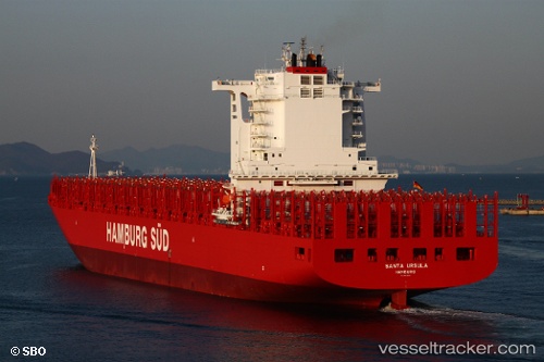
Vessel profile: Santa Ursula is a Container Ship with dimensions 300m x 43m.
This page combines live AIS, route history, probable destination signals, nearby traffic, and port activity for practical vessel monitoring.
The current position of vessel Santa Ursula is -0.34833 lat / -8.86167 lng. Updated: 2026-05-21 19:39:54 UTCNearest reference points:
- Open sea, approx. 401 nm off the nearest listed port
- Open sea, approx. 402 nm off the nearest listed port
- Open sea, approx. 403 nm off the nearest listed port
Currently sailing under the flag of Denmark ![]()
Santa Ursula built in 2012 year
Deadweight:
93025 tDetails:
Live Vessel Santa Ursula Analytics (details, animations, etc.)
Recent AIS points (UTC):
2026-05-21 16:24:50 UTC · -1.16833, -8.24500 · SOG 18 kn · COG -1°2026-05-21 17:00:52 UTC · -1.01833, -8.35667 · SOG 18 kn · COG -1°
2026-05-21 17:51:52 UTC · -0.80667, -8.51833 · SOG 19 kn · COG -1°
2026-05-21 19:39:54 UTC · -0.34833, -8.86167 · SOG 19 kn · COG -1°