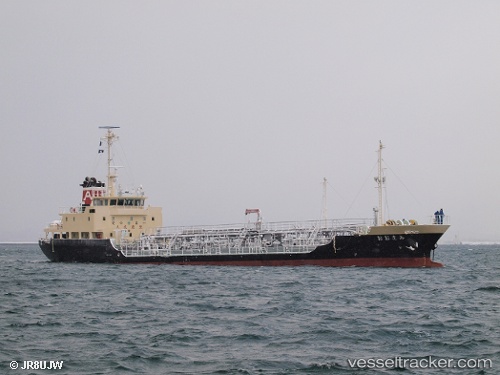
 Ohami
Ohami
Current Status
Where is the vessel?
Ohami is currently in Near Shimizu, based on AIS data received about 14h ago.
Latest AIS update:
Current position: 35.01721° N, 138.49500° E (Near Shimizu)
Average speed (last 7 days): Loading…
Average speed (last 30 days): Loading…
Vessel profile: Ohami is a Oil Products Tanker with dimensions 79m x 80m.
This page combines live AIS, route history, probable destination signals, nearby traffic, and port activity for practical vessel monitoring.
The current position of vessel Ohami is 35.01721 lat / 138.49500 lng. Updated: 2026-07-11 19:08:26 UTCNearest reference points:
- Near Shimizu
- Near OMAEZAKI
- Near Iruma
Currently sailing under the flag of Japan ![]()
Details:
Live Vessel Ohami Analytics (details, animations, etc.)
Recent AIS points (UTC):
2026-07-11 15:17:46 UTC · 35.01721, 138.49500 · SOG 0.2 kn · COG 117°2026-07-11 17:04:16 UTC · 35.01721, 138.49496 · SOG 0 kn · COG 118°
2026-07-11 17:27:16 UTC · 35.01723, 138.49496 · SOG 0.1 kn · COG 118°
2026-07-11 19:08:26 UTC · 35.01721, 138.49500 · SOG 0.1 kn · COG 118°