 vesseltracker.com
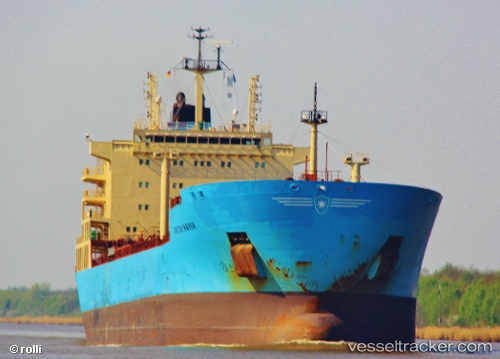
Kirsten Maersk
Current StatusWhere is the vessel?
Kirsten Maersk is currently in Near Zona Franca de Barcelona, based on AIS data received about 1h ago.
Latest AIS update:
Current position: 41.30362° N, 2.20785° E (Near Zona Franca de Barcelona)
Average speed (last 7 days): Loading…
Average speed (last 30 days): Loading…
Vessel profile: Kirsten Maersk is a Chemical Oil Products Tanker with dimensions 28m x 183m.
This page combines live AIS, route history, probable destination signals, nearby traffic, and port activity for practical vessel monitoring.
The current position of vessel Kirsten Maersk is 41.30362 lat / 2.20785 lng. Updated: 2026-04-27 23:41:40 UTCNearest reference points:
- Near Zona Franca de Barcelona
- Near Barcelona
- Near BADALONA
Details:
Live Vessel Kirsten Maersk Analytics (details, animations, etc.)
Recent AIS points (UTC):
2026-04-27 20:14:40 UTC · 41.30379, 2.20784 · SOG 0 kn · COG 25°2026-04-27 22:05:46 UTC · 41.30371, 2.20789 · SOG 0 kn · COG 18°
2026-04-27 22:50:40 UTC · 41.30363, 2.20774 · SOG 0.1 kn · COG 25°
2026-04-27 23:41:40 UTC · 41.30362, 2.20785 · SOG 0 kn · COG 26°