 vesseltracker.com
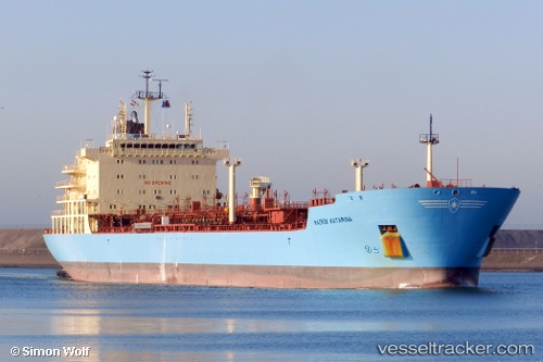
Maersk Katarina
Current StatusWhere is the vessel?
Maersk Katarina is currently in Near La Coruna , based on AIS data received less than 1h ago.
Latest AIS update:
Current position: 43.44467° N, 8.40648° W (Near La Coruna )
Average speed (last 7 days): Loading…
Average speed (last 30 days): Loading…
Vessel profile: Maersk Katarina is a Chemical Oil Products Tanker with dimensions 28m x 183m.
This page combines live AIS, route history, probable destination signals, nearby traffic, and port activity for practical vessel monitoring.
The current position of vessel Maersk Katarina is 43.44467 lat / -8.40648 lng. Updated: 2026-05-17 16:19:56 UTCNearest reference points:
- Near La Coruna
- Near PUNTA LANGOSTEIRA
- Near Ferrol
Details:
Live Vessel Maersk Katarina Analytics (details, animations, etc.)
Recent AIS points (UTC):
2026-05-17 13:58:13 UTC · 43.46350, -8.23619 · SOG 0 kn · COG 99°2026-05-17 14:07:04 UTC · 43.46346, -8.23620 · SOG 0 kn · COG 99°
2026-05-17 16:07:15 UTC · 43.44490, -8.34749 · SOG 10.9 kn · COG 256°
2026-05-17 16:19:56 UTC · 43.44467, -8.40648 · SOG 12.8 kn · COG 272°