 vesseltracker.com
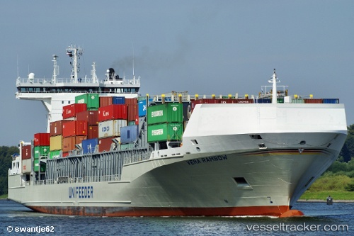
 Vera Rambow
Current Status
Where is the vessel?
Vera Rambow is currently in Near Saint-Martin-du-Manoir, based on AIS data received less than 1h ago.
Latest AIS update:
Current position: 49.59350° N, 0.38123° W (Near Saint-Martin-du-Manoir)
Average speed (last 7 days): Loading…
Average speed (last 30 days): Loading…
Vessel profile: Vera Rambow is a Container Ship with dimensions 168m x 26m.
This page combines live AIS, route history, probable destination signals, nearby traffic, and port activity for practical vessel monitoring.
The current position of vessel Vera Rambow is 49.5935 lat / -0.381235 lng. Updated: 2026-05-14 18:10:18 UTCNearest reference points:
- Near Port-en-Bessin-Huppain
- Near Caen
- Near PORT EN BESSIN
Currently sailing under the flag of Germany ![]()
Vera Rambow built in 2008 year
Deadweight:
17888 tDetails:
Live Vessel Vera Rambow Analytics (details, animations, etc.)
Recent AIS points (UTC):
2026-05-14 16:09:58 UTC · 49.45800, 0.16174 · SOG 0 kn · COG 283°2026-05-14 16:17:53 UTC · 49.45760, 0.15731 · SOG 7.3 kn · COG 274°
2026-05-14 16:35:12 UTC · 49.47770, 0.08986 · SOG 11.7 kn · COG 315°
2026-05-14 18:10:18 UTC · 49.59350, -0.38124 · SOG 13.2 kn · COG 289°