 Sider Monica
Current Status
Where is the vessel?
Sider Monica is currently in Near Musel-Arnao, based on AIS data received about 14h ago.
Latest AIS update:
Current position: 43.57950° N, 5.68850° W (Near Musel-Arnao)
Average speed (last 7 days): Loading…
Average speed (last 30 days): Loading…
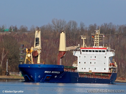
Vessel profile: Sider Monica is a Multi Purpose Carrier with dimensions 108m x 18m.
This page combines live AIS, route history, probable destination signals, nearby traffic, and port activity for practical vessel monitoring.
The current position of vessel Sider Monica is 43.57950 lat / -5.68850 lng. Updated: 2026-05-20 16:03:40 UTCNearest reference points:
- Near Musel-Arnao
- Near Tremanes
- Near San Juan de Nieva
Currently sailing under the flag of Portugal ![]()
Sider Monica built in 2009 year
Deadweight:
8048 tDetails:
Live Vessel Sider Monica Analytics (details, animations, etc.)
Recent AIS points (UTC):
2026-05-20 11:39:42 UTC · 43.57950, -5.68850 · SOG 0 kn · COG 70°2026-05-20 13:21:41 UTC · 43.57950, -5.68850 · SOG 0 kn · COG 71°
2026-05-20 13:33:40 UTC · 43.57950, -5.68850 · SOG 0 kn · COG 71°
2026-05-20 16:03:40 UTC · 43.57950, -5.68850 · SOG 0 kn · COG 70°