 Olaf
Olaf
Current Status
Where is the vessel?
Olaf is currently in 284 nm E of Diego Garcia, based on AIS data received about 2d ago.
Latest AIS update:
Current position: 7.00233° S, 77.22298° E (284 nm E of Diego Garcia)
Average speed (last 7 days): Loading…
Average speed (last 30 days): Loading…
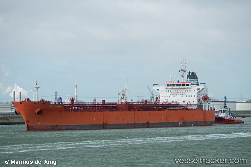
Vessel profile: Olaf is a Chemical Oil Products Tanker with dimensions 183m x 32m.
This page combines live AIS, route history, probable destination signals, nearby traffic, and port activity for practical vessel monitoring.
The current position of vessel Olaf is -7.00233 lat / 77.22298 lng. Updated: 2026-05-18 14:17:16 UTCNearest reference points:
- 284 nm E of Diego Garcia
- 208 nm E of Diego Garcia
- Open sea, approx. 400 nm off the nearest listed port
Currently sailing under the flag of Liberia ![]()
Olaf built in 2010 year
Deadweight:
51672 tDetails:
Live Vessel Olaf Analytics (details, animations, etc.)
Recent AIS points (UTC):
2026-05-18 14:17:16 UTC · -7.00233, 77.22298 · SOG 11.5 kn · COG -1°2026-05-18 14:17:16 UTC · -7.00233, 77.22298 · SOG 11.5 kn · COG -1°
2026-05-18 14:17:16 UTC · -7.00233, 77.22298 · SOG 11.5 kn · COG -1°
2026-05-18 14:17:16 UTC · -7.00233, 77.22298 · SOG 11.5 kn · COG -1°