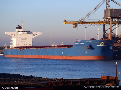
 Maran Harmony
Current Status
Where is the vessel?
Maran Harmony is currently in 281 nm SE of NANTUCKET, based on AIS data received about 14h ago.
Latest AIS update:
Current position: 38.19667° N, 65.50667° W (281 nm SE of NANTUCKET)
Average speed (last 7 days): Loading…
Average speed (last 30 days): Loading…
Vessel profile: Maran Harmony is a Bulk Carrier with dimensions 292m x 45m.
This page combines live AIS, route history, probable destination signals, nearby traffic, and port activity for practical vessel monitoring.
The current position of vessel Maran Harmony is 38.19667 lat / -65.50667 lng. Updated: 2026-05-19 19:55:12 UTCNearest reference points:
- 273 nm SE of NANTUCKET
Currently sailing under the flag of Greece ![]()
Maran Harmony built in 2010 year
Deadweight:
180391 tDetails:
Live Vessel Maran Harmony Analytics (details, animations, etc.)
Recent AIS points (UTC):
2026-05-19 17:04:09 UTC · 38.05833, -66.22500 · SOG 12 kn · COG -1°2026-05-19 18:19:09 UTC · 38.11667, -65.90667 · SOG 12 kn · COG -1°
2026-05-19 19:07:07 UTC · 38.15333, -65.70333 · SOG 12 kn · COG -1°
2026-05-19 19:55:12 UTC · 38.19667, -65.50667 · SOG 12 kn · COG -1°