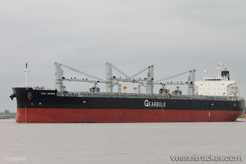
 TOKI ARROW
Current Status
Where is the vessel?
TOKI ARROW is currently in 96 nm E of Tan Cang Qui Nhon, based on AIS data received about 14h ago.
Latest AIS update:
Current position: 13.24720° N, 111.38753° E (96 nm E of Tan Cang Qui Nhon)
Average speed (last 7 days): Loading…
Average speed (last 30 days): Loading…
Vessel profile: TOKI ARROW is a General Cargo with dimensions m x m.
This page combines live AIS, route history, probable destination signals, nearby traffic, and port activity for practical vessel monitoring.
The current position of vessel TOKI ARROW is 13.24720 lat / 111.38753 lng. Updated: 2026-05-20 10:46:45 UTCNearest reference points:
- 29 nm NE of Vung Ro
- 226 nm SE of Tan Cang Qui Nhon
- 163 nm E of Vinh Cam Ranh
Currently sailing under the flag of Bahamas ![]()
Details:
Live Vessel TOKI ARROW Analytics (details, animations, etc.)
Recent AIS points (UTC):
2026-05-20 07:20:46 UTC · 13.76872, 111.70660 · SOG 10.7 kn · COG 217°2026-05-20 07:46:25 UTC · 13.70568, 111.66147 · SOG 10.8 kn · COG 220°
2026-05-20 09:47:55 UTC · 13.39880, 111.47288 · SOG 10.4 kn · COG 205°
2026-05-20 10:46:45 UTC · 13.24720, 111.38753 · SOG 10.6 kn · COG 213°