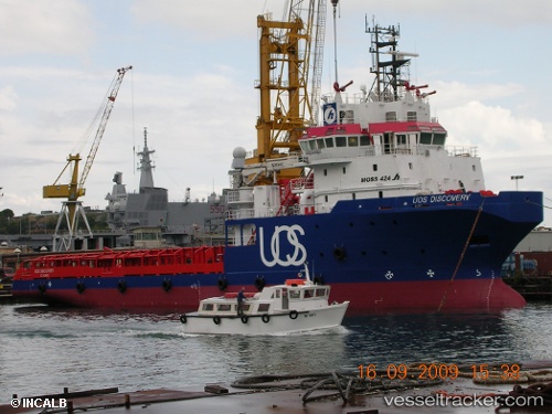
Gh Discovery
Current StatusWhere is the vessel?
Gh Discovery is currently in Near Floriana, based on AIS data received about 14h ago.
Latest AIS update:
Current position: 35.87848° N, 14.50094° E (Near Floriana)
Average speed (last 7 days): Loading…
Average speed (last 30 days): Loading…
Vessel profile: Gh Discovery is a Offshore Tug Supply Ship with dimensions 16m x 76m.
This page combines live AIS, route history, probable destination signals, nearby traffic, and port activity for practical vessel monitoring.
The current position of vessel Gh Discovery is 35.87848 lat / 14.50094 lng. Updated: 2026-06-04 15:44:28 UTCNearest reference points:
- Near Floriana
- Near Sliema
- Near Valletta
Details:
Live Vessel Gh Discovery Analytics (details, animations, etc.)
Recent AIS points (UTC):
2026-06-04 12:23:27 UTC · 35.87848, 14.50093 · SOG 0 kn · COG 30°2026-06-04 13:35:25 UTC · 35.87848, 14.50093 · SOG 0 kn · COG 30°
2026-06-04 13:50:26 UTC · 35.87848, 14.50094 · SOG 0 kn · COG 30°
2026-06-04 15:44:28 UTC · 35.87848, 14.50094 · SOG 0 kn · COG 30°