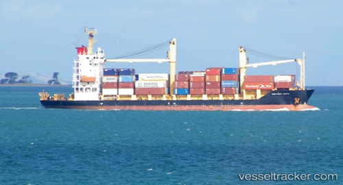
Gazelle Coast
Current StatusWhere is the vessel?
Gazelle Coast is currently in Near MADANG, based on AIS data received about 14h ago.
Latest AIS update:
Current position: 5.19728° S, 145.92328° E (Near MADANG)
Average speed (last 7 days): Loading…
Average speed (last 30 days): Loading…
Vessel profile: Gazelle Coast is a Container Ship with dimensions 20m x 116m.
This page combines live AIS, route history, probable destination signals, nearby traffic, and port activity for practical vessel monitoring.
The current position of vessel Gazelle Coast is -5.19728 lat / 145.92328 lng. Updated: 2026-05-19 19:42:46 UTCNearest reference points:
- Near Lae
- 46 nm NW of Kopi
Details:
Live Vessel Gazelle Coast Analytics (details, animations, etc.)
Recent AIS points (UTC):
2026-05-19 16:27:07 UTC · -5.21947, 145.95105 · SOG 0.6 kn · COG 257°2026-05-19 18:27:47 UTC · -5.20682, 145.93401 · SOG 0.6 kn · COG 188°
2026-05-19 19:21:48 UTC · -5.20152, 145.92561 · SOG 0.7 kn · COG 182°
2026-05-19 19:42:46 UTC · -5.19728, 145.92328 · SOG 0.8 kn · COG 208°