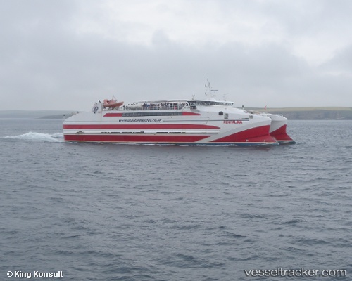
 Pentalina
Current Status
Where is the vessel?
Pentalina is currently in Near ST MARGARET'S HOPE, based on AIS data received about 15h ago.
Latest AIS update:
Current position: 58.83204° N, 2.96147° W (Near ST MARGARET'S HOPE)
Average speed (last 7 days): Loading…
Average speed (last 30 days): Loading…
Vessel profile: Pentalina is a Passenger Ro Ro Cargo Ship with dimensions 70m x 20m.
This page combines live AIS, route history, probable destination signals, nearby traffic, and port activity for practical vessel monitoring.
The current position of vessel Pentalina is 58.83204 lat / -2.96147 lng. Updated: 2026-07-08 04:06:00 UTCNearest reference points:
- Near Tingwall
- Near STROMNESS
- Near Staxigoe
Currently sailing under the flag of United Kingdom ![]()
Pentalina built in 2008 year
Deadweight:
360 tDetails:
Live Vessel Pentalina Analytics (details, animations, etc.)
Recent AIS points (UTC):
2026-07-08 01:06:51 UTC · 58.83202, -2.96146 · SOG 0 kn · COG 84°2026-07-08 02:24:03 UTC · 58.83201, -2.96143 · SOG 0 kn · COG 84°
2026-07-08 03:57:00 UTC · 58.83203, -2.96147 · SOG 0 kn · COG 84°
2026-07-08 04:06:00 UTC · 58.83204, -2.96147 · SOG 0 kn · COG 84°