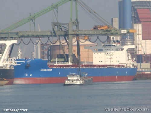
Anangel Mariner
Current StatusWhere is the vessel?
Anangel Mariner is currently in 35 nm NW of Bolinao, based on AIS data received about 15h ago.
Latest AIS update:
Current position: 16.91585° N, 119.64920° E (35 nm NW of Bolinao)
Average speed (last 7 days): Loading…
Average speed (last 30 days): Loading…
Vessel profile: Anangel Mariner is a Bulk Carrier with dimensions 46m x 292m.
This page combines live AIS, route history, probable destination signals, nearby traffic, and port activity for practical vessel monitoring.
The current position of vessel Anangel Mariner is 16.91585 lat / 119.64920 lng. Updated: 2026-05-20 08:57:29 UTCNearest reference points:
- 22 nm W of Salomague
- 34 nm W of Iba
- 138 nm NW of Bolinao
Details:
Live Vessel Anangel Mariner Analytics (details, animations, etc.)
Recent AIS points (UTC):
2026-05-20 06:17:11 UTC · 17.45833, 119.81667 · SOG 12 kn · COG -1°2026-05-20 07:32:10 UTC · 17.20333, 119.73833 · SOG 12 kn · COG -1°
2026-05-20 07:50:10 UTC · 17.14333, 119.71833 · SOG 12 kn · COG -1°
2026-05-20 08:57:29 UTC · 16.91585, 119.64920 · SOG 12.8 kn · COG 195°