 vesseltracker.com
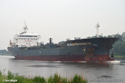
 ELISABETH SCHULTE
Current Status
Where is the vessel?
ELISABETH SCHULTE is currently in Near Fram, based on AIS data received about 14h ago.
Latest AIS update:
Current position: 60.96899° N, 3.62510° E (Near Fram)
Average speed (last 7 days): Loading…
Average speed (last 30 days): Loading…
Vessel profile: ELISABETH SCHULTE is a Oil/Chemical Tanker with dimensions m x m.
This page combines live AIS, route history, probable destination signals, nearby traffic, and port activity for practical vessel monitoring.
The current position of vessel ELISABETH SCHULTE is 60.96899 lat / 3.62510 lng. Updated: 2026-05-17 20:07:26 UTCNearest reference points:
- Near Solund
- Near Eivindvik
- Near Glesvær
Currently sailing under the flag of Marshall Islands ![]()
Details:
Live Vessel ELISABETH SCHULTE Analytics (details, animations, etc.)
Recent AIS points (UTC):
2026-05-17 16:14:44 UTC · 60.93795, 2.76017 · SOG 9.5 kn · COG 94°2026-05-17 18:06:05 UTC · 60.93368, 3.39707 · SOG 9.2 kn · COG 95°
2026-05-17 19:31:47 UTC · 60.96235, 3.62645 · SOG 0.5 kn · COG 115°
2026-05-17 20:07:26 UTC · 60.96899, 3.62510 · SOG 0.8 kn · COG 50°