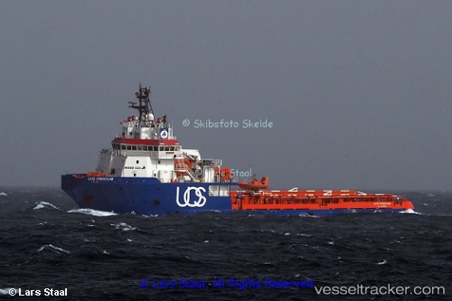
 Gh Freedom
Current Status
Where is the vessel?
Gh Freedom is currently in Near Agigea, based on AIS data received about 14h ago.
Latest AIS update:
Current position: 44.10013° N, 28.66500° E (Near Agigea)
Average speed (last 7 days): Loading…
Average speed (last 30 days): Loading…
Vessel profile: Gh Freedom is a Offshore Tug Supply Ship with dimensions 77m x 18m.
This page combines live AIS, route history, probable destination signals, nearby traffic, and port activity for practical vessel monitoring.
The current position of vessel Gh Freedom is 44.10013 lat / 28.66500 lng. Updated: 2026-05-20 18:05:01 UTCNearest reference points:
- Near Constanta
- Near Ovidiu
- Near MIDIA
Currently sailing under the flag of Antigua Barbuda ![]()
Gh Freedom built in 2010 year
Deadweight:
3006 tDetails:
Live Vessel Gh Freedom Analytics (details, animations, etc.)
Recent AIS points (UTC):
2026-05-20 13:50:03 UTC · 44.10013, 28.66500 · SOG 0 kn · COG 2°2026-05-20 15:53:03 UTC · 44.10012, 28.66500 · SOG 0 kn · COG 2°
2026-05-20 16:11:01 UTC · 44.10012, 28.66500 · SOG 0 kn · COG 2°
2026-05-20 18:05:01 UTC · 44.10013, 28.66500 · SOG 0 kn · COG 1°