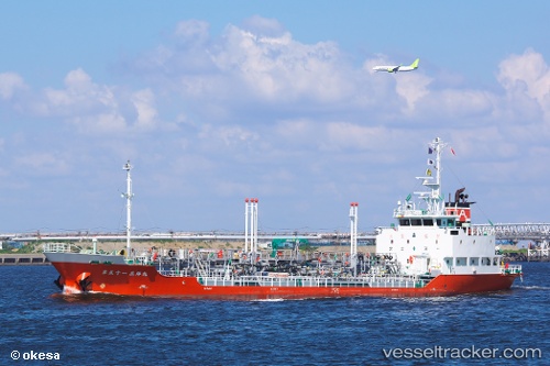
Sanyomaru No.51
Current StatusWhere is the vessel?
Sanyomaru No.51 is currently in Near TSUKUMI, based on AIS data received about 22h ago.
Latest AIS update:
Current position: 33.19252° N, 132.01639° E (Near TSUKUMI)
Average speed (last 7 days): Loading…
Average speed (last 30 days): Loading…
Vessel profile: Sanyomaru No.51 is a Oil Products Tanker with dimensions 12m x 67m.
This page combines live AIS, route history, probable destination signals, nearby traffic, and port activity for practical vessel monitoring.
The current position of vessel Sanyomaru No.51 is 33.19252 lat / 132.01639 lng. Updated: 2026-05-20 11:45:58 UTCNearest reference points:
- 11 nm E of SAEKI
- Near Kitsuki
- Near Oita
Details:
Live Vessel Sanyomaru No.51 Analytics (details, animations, etc.)
Recent AIS points (UTC):
2026-05-20 11:45:58 UTC · 33.19252, 132.01639 · SOG 15.1 kn · COG 308°2026-05-20 11:45:58 UTC · 33.19252, 132.01639 · SOG 15.1 kn · COG 308°
2026-05-20 11:45:58 UTC · 33.19252, 132.01639 · SOG 15.1 kn · COG 308°
2026-05-20 11:45:58 UTC · 33.19252, 132.01639 · SOG 15.1 kn · COG 308°