 Isemaru
Current Status
Where is the vessel?
Isemaru is currently in 17 nm NE of Kashima Ko, based on AIS data received about 14h ago.
Latest AIS update:
Current position: 36.15610° N, 140.98935° E (17 nm NE of Kashima Ko)
Average speed (last 7 days): Loading…
Average speed (last 30 days): Loading…
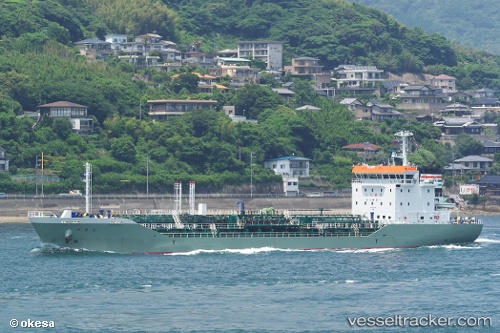
Vessel profile: Isemaru is a Chemical Oil Products Tanker with dimensions 104m x 16m.
This page combines live AIS, route history, probable destination signals, nearby traffic, and port activity for practical vessel monitoring.
The current position of vessel Isemaru is 36.15610 lat / 140.98935 lng. Updated: 2026-07-09 17:31:07 UTCNearest reference points:
- Near KASHIMA
- 12 nm E of CHOSHI
- Near Mito
Currently sailing under the flag of Japan ![]()
Details:
Live Vessel Isemaru Analytics (details, animations, etc.)
Recent AIS points (UTC):
2026-07-09 06:26:21 UTC · 35.53675, 140.02435 · SOG 11.9 kn · COG 272°2026-07-09 07:43:20 UTC · 35.41265, 139.72588 · SOG 13.4 kn · COG 228°
2026-07-09 07:45:20 UTC · 35.40691, 139.72078 · SOG 12.9 kn · COG 205°
2026-07-09 17:31:07 UTC · 36.15610, 140.98935 · SOG 13.1 kn · COG -1°