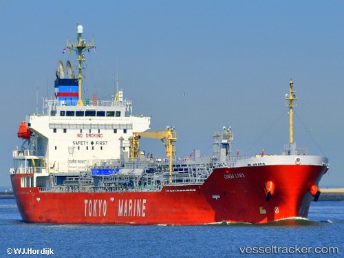
Ginga Lynx
Current StatusWhere is the vessel?
Ginga Lynx is currently in 15 nm S of Conakry Eco, based on AIS data received about 15h ago.
Latest AIS update:
Current position: 9.25227° N, 13.77295° W (15 nm S of Conakry Eco)
Average speed (last 7 days): Loading…
Average speed (last 30 days): Loading…
Vessel profile: Ginga Lynx is a Chemical Oil Products Tanker with dimensions 26m x 160m.
This page combines live AIS, route history, probable destination signals, nearby traffic, and port activity for practical vessel monitoring.
The current position of vessel Ginga Lynx is 9.25227 lat / -13.77295 lng. Updated: 2026-05-20 01:51:48 UTCNearest reference points:
- 28 nm S of Conakry
- Near Conakry
- Near NASSIT
Details:
Live Vessel Ginga Lynx Analytics (details, animations, etc.)
Recent AIS points (UTC):
2026-05-19 23:03:47 UTC · 9.25277, -13.77187 · SOG 0.1 kn · COG 314°2026-05-20 00:12:47 UTC · 9.25231, -13.77243 · SOG 0 kn · COG 343°
2026-05-20 01:12:47 UTC · 9.25234, -13.77265 · SOG 0.1 kn · COG 342°
2026-05-20 01:51:48 UTC · 9.25227, -13.77295 · SOG 0 kn · COG 354°