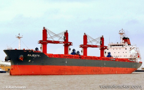
Majesty
Current StatusWhere is the vessel?
Majesty is currently in 118 nm E of San Andrés, based on AIS data received about 14h ago.
Latest AIS update:
Current position: 12.13207° N, 79.74775° W (118 nm E of San Andrés)
Average speed (last 7 days): Loading…
Average speed (last 30 days): Loading…
Vessel profile: Majesty is a Bulk Carrier with dimensions 30m x 180m.
This page combines live AIS, route history, probable destination signals, nearby traffic, and port activity for practical vessel monitoring.
The current position of vessel Majesty is 12.13207 lat / -79.74775 lng. Updated: 2026-05-24 14:10:11 UTCNearest reference points:
- 62 nm NE of Playón Chico
Details:
Live Vessel Majesty Analytics (details, animations, etc.)
Recent AIS points (UTC):
2026-05-24 10:31:41 UTC · 12.72283, -79.72147 · SOG 9.7 kn · COG 180°2026-05-24 12:05:10 UTC · 12.47503, -79.73148 · SOG 9.7 kn · COG 172°
2026-05-24 13:39:40 UTC · 12.21703, -79.74240 · SOG 9.9 kn · COG 180°
2026-05-24 14:10:11 UTC · 12.13207, -79.74775 · SOG 10.2 kn · COG 178°