 vesseltracker.com
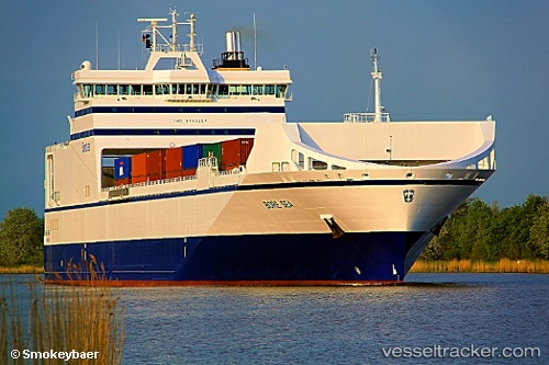
 Bore Sea
Current Status
Where is the vessel?
Bore Sea is currently in Near HANKO, based on AIS data received about 15h ago.
Latest AIS update:
Current position: 59.82311° N, 22.94795° E (Near HANKO)
Average speed (last 7 days): Loading…
Average speed (last 30 days): Loading…
Vessel profile: Bore Sea is a Ro Ro Cargo Ship with dimensions 195m x 26m.
This page combines live AIS, route history, probable destination signals, nearby traffic, and port activity for practical vessel monitoring.
The current position of vessel Bore Sea is 59.82311 lat / 22.94795 lng. Updated: 2026-05-18 04:14:01 UTCNearest reference points:
- Near Hango
- Near Tvärminne
- Near Mahu Sadam
Currently sailing under the flag of Netherlands ![]()
Bore Sea built in 2011 year
Deadweight:
13375 tDetails:
Live Vessel Bore Sea Analytics (details, animations, etc.)
Recent AIS points (UTC):
2026-05-18 02:18:13 UTC · 59.64571, 23.00410 · SOG 12.7 kn · COG 25°2026-05-18 02:18:33 UTC · 59.64683, 23.00512 · SOG 12.6 kn · COG 24°
2026-05-18 03:56:09 UTC · 59.82311, 22.94793 · SOG 0 kn · COG 201°
2026-05-18 04:14:01 UTC · 59.82311, 22.94795 · SOG 0 kn · COG 200°