 vesseltracker.com
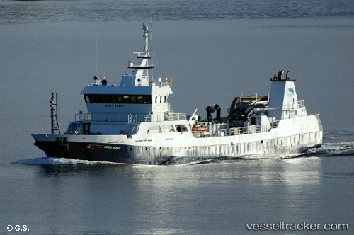
Ronja Nordic
Current StatusWhere is the vessel?
Ronja Nordic is currently in Near WAIKAWA, based on AIS data received less than 1h ago.
Latest AIS update:
Current position: 41.28321° S, 174.00543° E (Near WAIKAWA)
Average speed (last 7 days): Loading…
Average speed (last 30 days): Loading…
Vessel profile: Ronja Nordic is a Fish Carrier with dimensions 12m x 57m.
This page combines live AIS, route history, probable destination signals, nearby traffic, and port activity for practical vessel monitoring.
The current position of vessel Ronja Nordic is -41.28321 lat / 174.00543 lng. Updated: 2026-05-15 12:13:41 UTCNearest reference points:
- Near WAIKAWA
- Near Renwick
- Near Nelson
Details:
Live Vessel Ronja Nordic Analytics (details, animations, etc.)
Recent AIS points (UTC):
2026-05-15 07:43:47 UTC · -41.28318, 174.00543 · SOG 0 kn · COG 43°2026-05-15 09:22:46 UTC · -41.28315, 174.00542 · SOG 0 kn · COG 43°
2026-05-15 10:31:42 UTC · -41.28319, 174.00545 · SOG 0 kn · COG 43°
2026-05-15 12:13:41 UTC · -41.28321, 174.00543 · SOG 0 kn · COG 43°