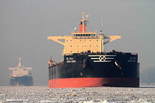
 HL SINES
Current Status
Where is the vessel?
HL SINES is currently in 326 nm NW of Sapiranga, based on AIS data received about 15h ago.
Latest AIS update:
Current position: 25.10105° S, 28.47813° W (326 nm NW of Sapiranga)
Average speed (last 7 days): Loading…
Average speed (last 30 days): Loading…
Vessel profile: HL SINES is a Bulk Carrier with dimensions m x m.
This page combines live AIS, route history, probable destination signals, nearby traffic, and port activity for practical vessel monitoring.
The current position of vessel HL SINES is -25.10105 lat / -28.47813 lng. Updated: 2026-05-21 04:16:14 UTCNearest reference points:
- Open sea, approx. 415 nm off the nearest listed port
- Open sea, approx. 405 nm off the nearest listed port
- Open sea, approx. 410 nm off the nearest listed port
Currently sailing under the flag of Marshall Islands ![]()
Details:
Live Vessel HL SINES Analytics (details, animations, etc.)
Recent AIS points (UTC):
2026-05-21 01:26:58 UTC · -25.15007, -27.91400 · SOG 10.8 kn · COG 281°2026-05-21 02:29:55 UTC · -25.12973, -28.12620 · SOG 11 kn · COG 278°
2026-05-21 03:31:56 UTC · -25.11472, -28.33242 · SOG 11.1 kn · COG 279°
2026-05-21 04:16:14 UTC · -25.10105, -28.47813 · SOG 10.9 kn · COG 278°