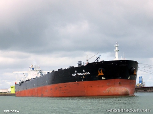
 New Vanguard
Current Status
Where is the vessel?
New Vanguard is currently in Near Tai Tam, based on AIS data received about 14h ago.
Latest AIS update:
Current position: 22.15618° N, 114.14642° E (Near Tai Tam)
Average speed (last 7 days): Loading…
Average speed (last 30 days): Loading…
Vessel profile: New Vanguard is a Crude Oil Tanker with dimensions 330m x 60m.
This page combines live AIS, route history, probable destination signals, nearby traffic, and port activity for practical vessel monitoring.
The current position of vessel New Vanguard is 22.15618 lat / 114.14642 lng. Updated: 2026-07-09 23:53:32 UTCNearest reference points:
- Near Pok Fu Lam
- Near Tai Tam
- Near WAILINGDING ISLAND
Currently sailing under the flag of Liberia ![]()
New Vanguard built in 2011 year
Deadweight:
297115 tDetails:
Live Vessel New Vanguard Analytics (details, animations, etc.)
Recent AIS points (UTC):
2026-07-09 19:29:33 UTC · 22.15833, 114.14591 · SOG 0 kn · COG 234°2026-07-09 21:38:31 UTC · 22.15714, 114.14654 · SOG 0.1 kn · COG 265°
2026-07-09 22:38:30 UTC · 22.15665, 114.14663 · SOG 0.1 kn · COG 276°
2026-07-09 23:53:32 UTC · 22.15618, 114.14642 · SOG 0.1 kn · COG 279°