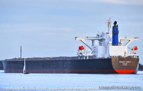
 STAR VESTA
Current Status
Where is the vessel?
STAR VESTA is currently in 253 nm SW of Monrovia, based on AIS data received about 14h ago.
Latest AIS update:
Current position: 2.94167° N, 13.33227° W (253 nm SW of Monrovia)
Average speed (last 7 days): Loading…
Average speed (last 30 days): Loading…
Vessel profile: STAR VESTA is a Bulk Carrier with dimensions m x m.
This page combines live AIS, route history, probable destination signals, nearby traffic, and port activity for practical vessel monitoring.
The current position of vessel STAR VESTA is 2.94167 lat / -13.33227 lng. Updated: 2026-06-19 04:10:35 UTCNearest reference points:
- Open sea, approx. 400 nm off the nearest listed port
- Open sea, approx. 401 nm off the nearest listed port
- Open sea, approx. 403 nm off the nearest listed port
Currently sailing under the flag of Marshall Islands ![]()
Details:
Live Vessel STAR VESTA Analytics (details, animations, etc.)
Recent AIS points (UTC):
2026-06-19 02:00:18 UTC · 3.28192, -13.49873 · SOG 10.6 kn · COG 153°2026-06-19 02:12:09 UTC · 3.25038, -13.48337 · SOG 10.5 kn · COG 153°
2026-06-19 03:59:27 UTC · 2.97032, -13.34741 · SOG 10.4 kn · COG 151°
2026-06-19 04:10:35 UTC · 2.94167, -13.33227 · SOG 10.3 kn · COG 151°