 SHENG TAI
Current Status
Where is the vessel?
SHENG TAI is currently in 11 nm NW of AL HAMRA, based on AIS data received about 14h ago.
Latest AIS update:
Current position: 25.79290° N, 55.59772° E (11 nm NW of AL HAMRA)
Average speed (last 7 days): Loading…
Average speed (last 30 days): Loading…
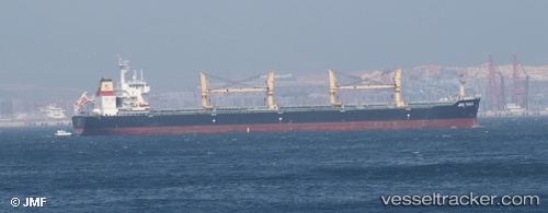
Vessel profile: SHENG TAI is a Bulk Carrier with dimensions m x m.
This page combines live AIS, route history, probable destination signals, nearby traffic, and port activity for practical vessel monitoring.
The current position of vessel SHENG TAI is 25.79290 lat / 55.59772 lng. Updated: 2026-05-21 03:17:37 UTCNearest reference points:
- 13 nm NW of Hulaylah Terminal
- Near Al Hamriyah
- Near Ras Al Khaimah
Currently sailing under the flag of Panama ![]()
Details:
Live Vessel SHENG TAI Analytics (details, animations, etc.)
Recent AIS points (UTC):
2026-05-21 03:17:37 UTC · 25.79290, 55.59772 · SOG 3.5 kn · COG 232°2026-05-21 03:17:37 UTC · 25.79290, 55.59772 · SOG 3.5 kn · COG 232°
2026-05-21 03:17:37 UTC · 25.79290, 55.59772 · SOG 3.5 kn · COG 232°
2026-05-21 03:17:37 UTC · 25.79290, 55.59772 · SOG 3.5 kn · COG 232°