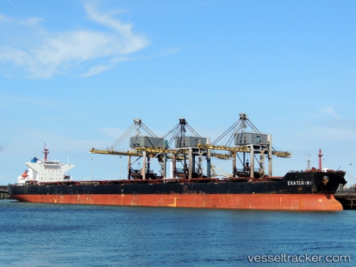
 EKATERINI
Current Status
Where is the vessel?
EKATERINI is currently in Open sea (no nearby ports in database), based on AIS data received about 14h ago.
Latest AIS update:
Current position: 35.93667° N, 158.71500° W (Open sea (no nearby ports in database))
Average speed (last 7 days): Loading…
Average speed (last 30 days): Loading…
Vessel profile: EKATERINI is a Bulk Carrier with dimensions m x m.
This page combines live AIS, route history, probable destination signals, nearby traffic, and port activity for practical vessel monitoring.
The current position of vessel EKATERINI is 35.93667 lat / -158.71500 lng. Updated: 2026-05-24 10:01:39 UTCNearest reference points:
- Open sea (no nearby ports in database)
Details:
Live Vessel EKATERINI Analytics (details, animations, etc.)
Recent AIS points (UTC):
2026-05-24 05:32:36 UTC · 35.90037, -160.47043 · SOG 19.3 kn · COG 89°2026-05-24 07:11:19 UTC · 35.91492, -159.82314 · SOG 19 kn · COG 90°
2026-05-24 07:20:37 UTC · 35.91632, -159.76257 · SOG 19 kn · COG 89°
2026-05-24 10:01:39 UTC · 35.93667, -158.71500 · SOG 19 kn · COG -1°