 PIONEER IV
Current Status
Where is the vessel?
PIONEER IV is currently in Near TANGER MED, based on AIS data received about 15h ago.
Latest AIS update:
Current position: 35.89419° N, 5.49284° W (Near TANGER MED)
Average speed (last 7 days): Loading…
Average speed (last 30 days): Loading…
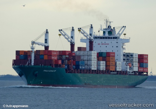
Vessel profile: PIONEER IV is a Container Ship with dimensions m x m.
This page combines live AIS, route history, probable destination signals, nearby traffic, and port activity for practical vessel monitoring.
The current position of vessel PIONEER IV is 35.89419 lat / -5.49284 lng. Updated: 2026-05-20 11:37:21 UTCNearest reference points:
- Near TARIFA
- Near TANGER MED
- Near Algeciras
Currently sailing under the flag of Marshall Islands ![]()
Details:
Live Vessel PIONEER IV Analytics (details, animations, etc.)
Recent AIS points (UTC):
2026-05-20 07:30:02 UTC · 36.00075, -5.37731 · SOG 14.2 kn · COG 256°2026-05-20 09:55:13 UTC · 35.89412, -5.49270 · SOG 0 kn · COG 44°
2026-05-20 10:31:16 UTC · 35.89407, -5.49270 · SOG 0 kn · COG 44°
2026-05-20 11:37:21 UTC · 35.89419, -5.49284 · SOG 0 kn · COG 43°