 ATAHUALPA
Current Status
Where is the vessel?
ATAHUALPA is currently in 11 nm SE of Obock, based on AIS data received about 14h ago.
Latest AIS update:
Current position: 11.83318° N, 43.37280° E (11 nm SE of Obock)
Average speed (last 7 days): Loading…
Average speed (last 30 days): Loading…
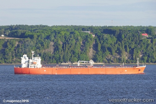
Vessel profile: ATAHUALPA is a Oil Products Tanker with dimensions 180m x 32m.
This page combines live AIS, route history, probable destination signals, nearby traffic, and port activity for practical vessel monitoring.
The current position of vessel ATAHUALPA is 11.83318 lat / 43.37280 lng. Updated: 2026-07-13 22:35:46 UTCNearest reference points:
- Near Djibouti
Currently sailing under the flag of Marshall Islands ![]()
ATAHUALPA built in 2010 year
Deadweight:
46549 tDetails:
Live Vessel ATAHUALPA Analytics (details, animations, etc.)
Recent AIS points (UTC):
2026-07-13 19:16:56 UTC · 12.37232, 43.56615 · SOG 11.9 kn · COG 161°2026-07-13 20:05:06 UTC · 12.21912, 43.61397 · SOG 12.2 kn · COG 177°
2026-07-13 21:50:56 UTC · 11.91228, 43.50765 · SOG 12.4 kn · COG 240°
2026-07-13 22:35:46 UTC · 11.83318, 43.37280 · SOG 12.3 kn · COG 253°