 Arica Bridge
Current Status
Where is the vessel?
Arica Bridge is currently in Near Haicang, based on AIS data received about 14h ago.
Latest AIS update:
Current position: 24.44555° N, 118.01463° E (Near Haicang)
Average speed (last 7 days): Loading…
Average speed (last 30 days): Loading…
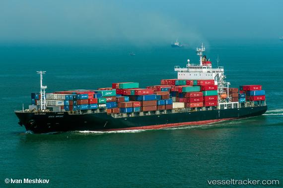
Vessel profile: Arica Bridge is a Container Ship with dimensions 199m x 32m.
This page combines live AIS, route history, probable destination signals, nearby traffic, and port activity for practical vessel monitoring.
The current position of vessel Arica Bridge is 24.44555 lat / 118.01463 lng. Updated: 2026-05-20 02:15:53 UTCNearest reference points:
- Near Hsia-Men
- Near ZHANGZHOU
- Near Haicang
Currently sailing under the flag of Panama ![]()
Arica Bridge built in 2010 year
Deadweight:
32997 tDetails:
Live Vessel Arica Bridge Analytics (details, animations, etc.)
Recent AIS points (UTC):
2026-05-19 23:09:52 UTC · 24.44547, 118.01459 · SOG 0 kn · COG 281°2026-05-20 00:06:54 UTC · 24.44551, 118.01467 · SOG 0 kn · COG 281°
2026-05-20 02:00:54 UTC · 24.44557, 118.01461 · SOG 0 kn · COG 282°
2026-05-20 02:15:53 UTC · 24.44555, 118.01463 · SOG 0 kn · COG 281°